
What makes a place Karoo?
Perhaps the most accurate definition is that the Karoo begins wherever dryness becomes the organising fact of life: where water determines settlement, distance defines community and people learn that survival depends not on conquering the land, but on understanding its limits.
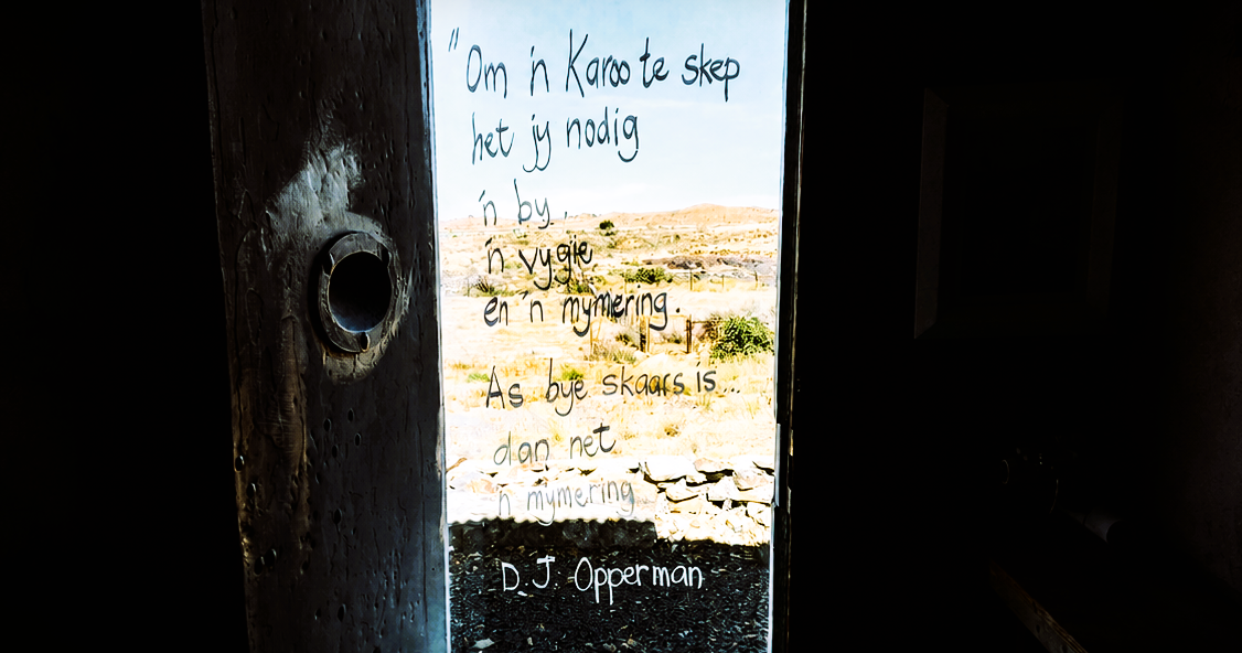
Ask where the Karoo begins and you'll have a different answer depending on whether you're speaking to a botanist, geologist, historian, farmer or someone whose family has lived there for generations.
The Karoo has no official boundary line, but crosses four provinces, gradually merging into Namaqualand, Bushmanland, the southern Free State, the Eastern Cape grasslands and the mountains of the Western Cape.
Some towns identify strongly as Karoo communities despite lying near its ecological margins. Other places fall inside a Karoo biome but are seldom described that way by the people who live there.
The Karoo is a collection of dry regions connected by climate, ecology, history and culture, but divided by rainfall seasons, altitude, vegetation and different cultural experiences.
So, what makes a place Karoo?
A name derived from dryness
The word “Karoo” comes from a Khoe language and is associated with hardness and aridity. The Dictionary of South African English traces the name to words including karo, karro and garo, meaning hard or dry, as well as !gar-b, meaning desert.
“Land of thirst” is the popular translation, as it captures the feeling of the place, although it's more poetic interpretation than exact linguistic definition.
Dryness is certainly the Karoo’s most obvious feature, but even that doesn't produce a clean boundary. Some parts receive most of their rain in winter. Others depend on summer thunderstorms. Mountain slopes can be considerably wetter than the plains below, while the eastern Karoo supports more grass than the succulent-rich west. The Karoo isn't dry in one, definable way.
The Great Karoo and the Klein Karoo
The broadest geographical division is between the Great Karoo and the Klein Karoo.
The Klein Karoo is located in a long valley between the Langeberg and Outeniqua mountains to the south and the Swartberg to the north. It runs from Montagu and Barrydale through Ladismith, Calitzdorp and Oudtshoorn towards De Rust and Willowmore.
The Klein Karoo's mountains lend it a clear, definable identity. Rivers descending their sloped have also made irrigated agriculture possible in places, supporting fruit and lucerne alongside livestock and ostrich farming.
The Great Karoo lies north of the Swartberg and the other Cape Fold mountains. Its northern and eastern boundaries are much harder to draw. The land gradually blends into Bushmanland, the Upper Karoo, the southern Free State and the grassier interior of the Eastern Cape.
Within this enormous area are smaller regions with their own names and identities: the Tankwa, Hantam, Roggeveld, Moordenaarskaroo, Koup, Camdeboo and Upper Karoo. These aren't official provinces within the Karoo, but their borders overlap and different residents place them differently.
Two ecological Karoos
A botanist sees the Karoo through ecological processes. The two most important divisions from this perspective are the Nama-Karoo and Succulent Karoo biomes.
The Nama-Karoo covers much of South Africa’s arid central plateau, receiving most of its rain during summer, often through irregular thunderstorms. Dwarf shrubs and grasses dominate, with grass becoming more prominent towards the east and north-east.
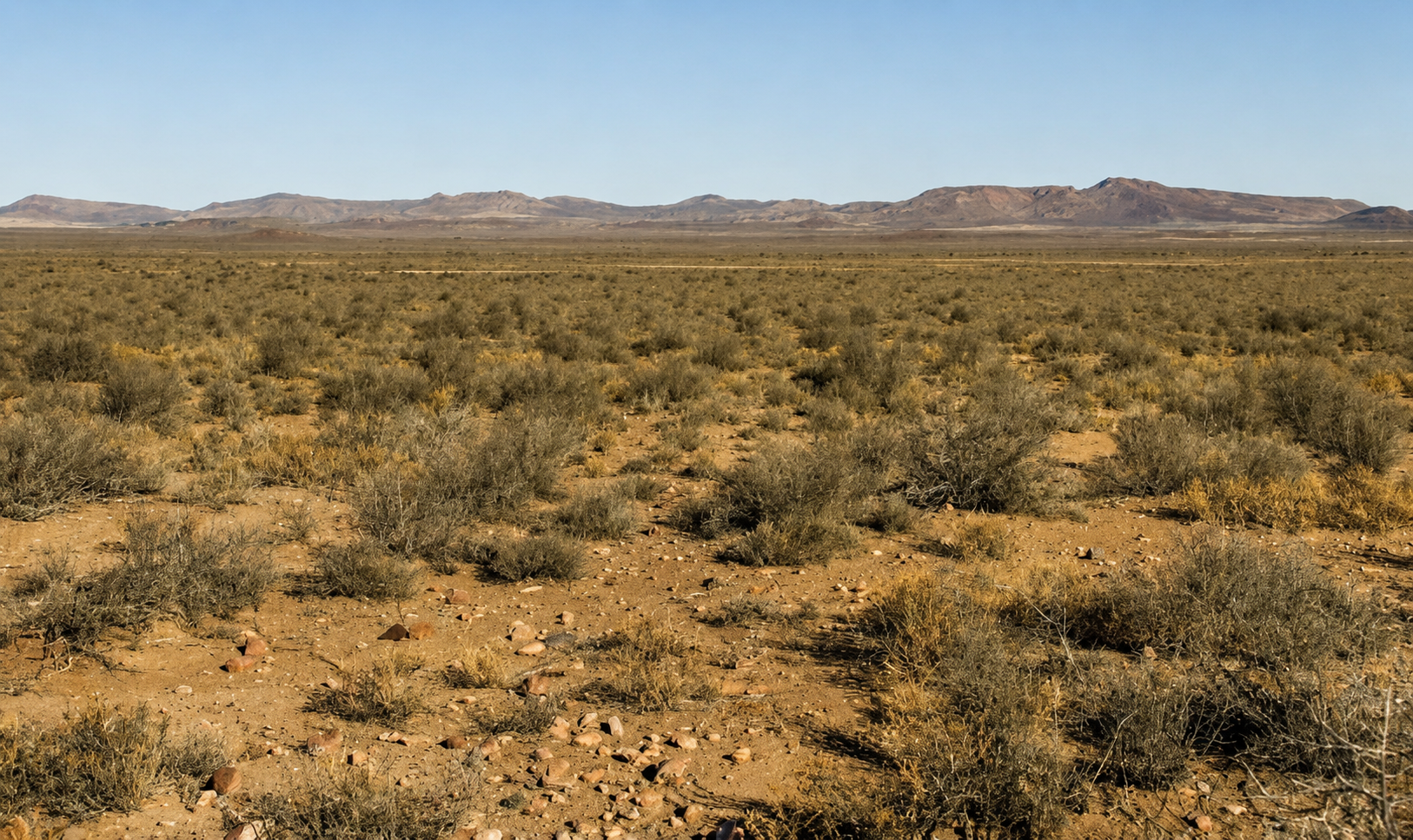
The amount and timing of rain determines the balance between shrubs and grass. Grazing pressure further complicates the picture, so that the Nama-Karoo doesn't look the same everywhere.
The Succulent Karoo is mainly towards the west, defined by low winter rainfall and exceptionally dry summers. According to SANBI, annual rainfall can range from approximately 20mm to 290mm, while summer temperatures can exceed 40°C.
The biome supports an extraordinary variety of succulents, bulbs and annual flowers. The region extends northwards through Namaqualand into Namibia, as well as inland into areas including the Tankwa and western Klein Karoo. An important distinction here is that not everything in the Succulent Karoo biome is ordinarily called “the Karoo”, while not every geographical Karoo area falls neatly within the Succulent Karoo.
Ecological boundaries also change gradually. There's no point on the road where the Nama-Karoo ends in one camp and the Succulent Karoo begins at the next fence.
A geological Karoo far larger than the land
“Karoo” has another meaning for geologists. The Karoo Supergroup is a vast sequence of sedimentary and volcanic rocks formed between roughly 300 million and 180 million years ago. These rocks extend far beyond the region that South Africans recognise geographically as the Karoo.
The Karoo Supergroup one of the world’s most valuable fossil records. Karoo rocks contain evidence of ancient plants and animals that lived before and after the end-Permian mass extinction, the most severe extinction event known in Earth’s history. Later, molten rock pushed between the sedimentary layers and hardened into dolerite. As the softer material eroded, the resistant dolerite helped create the flat-topped koppies and stepped ridges now strongly associated with the Great Karoo.
The geological Karoo is therefore larger than the cultural and geographical Karoo. A place can be located on Karoo Supergroup rock without its residents thinking of themselves as Karoo people.
The Tankwa is an extreme western basin
The Tankwa Karoo is located between the Cederberg and Roggeveld escarpment, and is one of the driest parts of the wider region with strong Succulent Karoo influences. Tankwa's low plains can be brutally hot, while the escarpment above experiences a much colder climate. Sparse vegetation and limited surface water have defined every form of land use.
San hunter-gatherers and Khoe pastoralists moved through this region long before it was divided into farms. Trekboers later used it for seasonal grazing before permanent farms redefined livestock management.
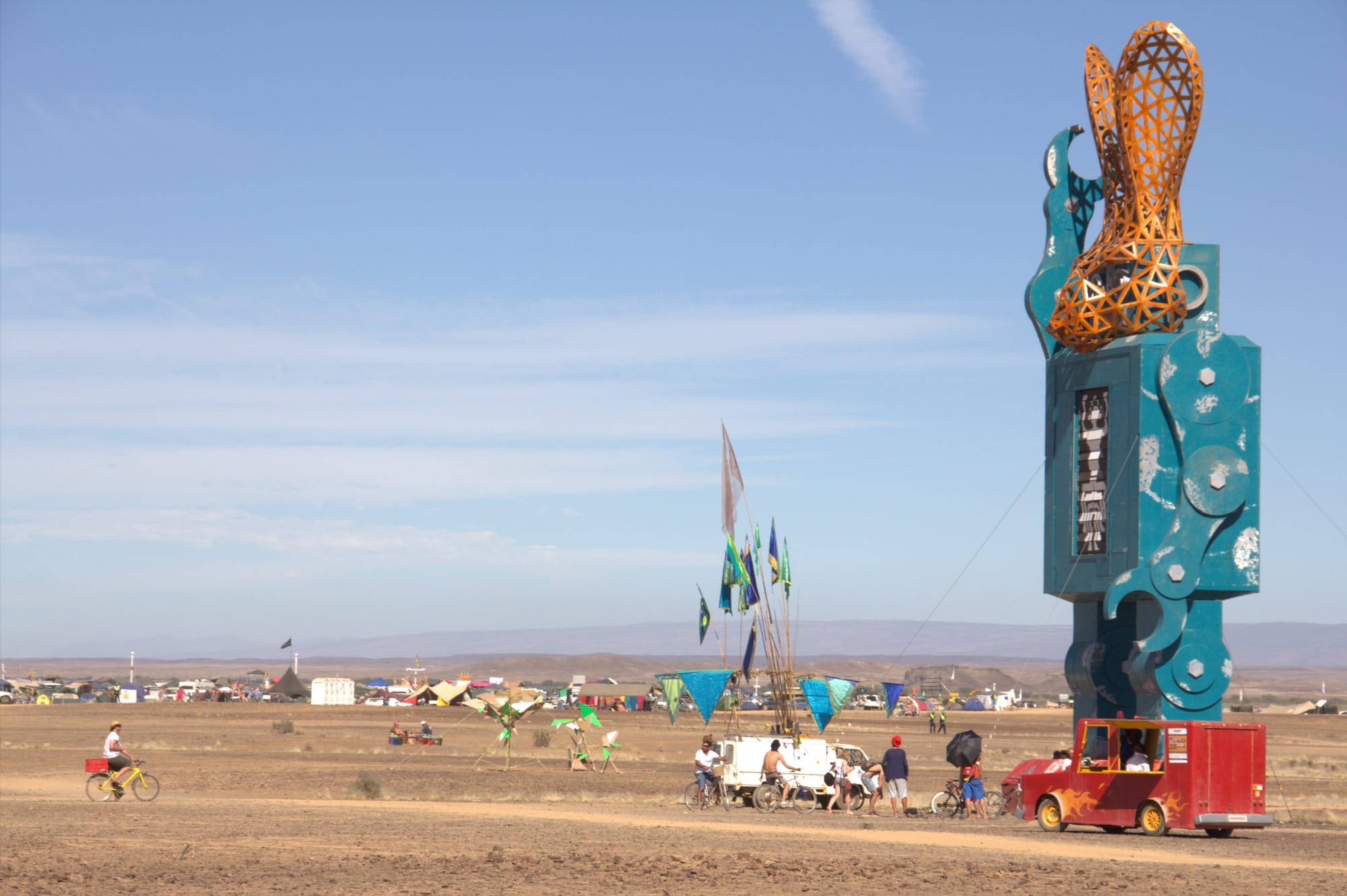
Today the Tankwa combines farming, conservation, tourism and AfrikaBurn’s temporary desert city. The region is still distinctly Karoo, but looks and functions very differently from the grassier districts around Cradock or Colesberg.
The Hantam and Roggeveld - the high, cold Karoo
Altitude alters the experience of aridity around Calvinia, Nieuwoudtville, Middelpos and Sutherland. The Hantam and Roggeveld are known for cold winters with hard frost and occasional snow. The Roggeveld escarpment rises sharply above the Tankwa basin to create one of the Karoo’s most dramatic changes in elevation.
Nieuwoudtville is near the meeting point of several ecological systems and is famous for its spring flowers and bulbs. The surrounding region demonstrates why the Karoo can't simply be described as empty brown shrubland. A place can be dry for much of the year and then produce an astounding botanical display after seasonal rain.
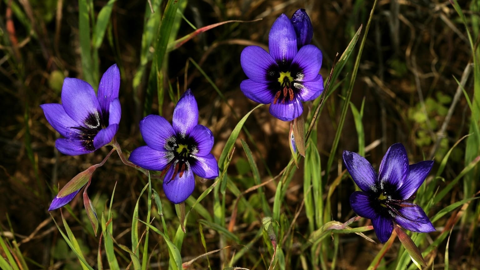
Farming has traditionally centred on livestock, but the vegetation and carrying capacity differ considerably between the high plateau and lower plains.
The Koup - the Karoo of long roads and open plains
The Koup is associated with the country around Laingsburg, Prince Albert Road, Merweville and the approaches to Beaufort West.
This is probably the Karoo most familiar to travellers on the N1: immense plains ridged by distant mountains and isolated farmhouses. The landscape looks empty from the road but is criss-crossed by farm tracks and histories that aren't immediately visible.
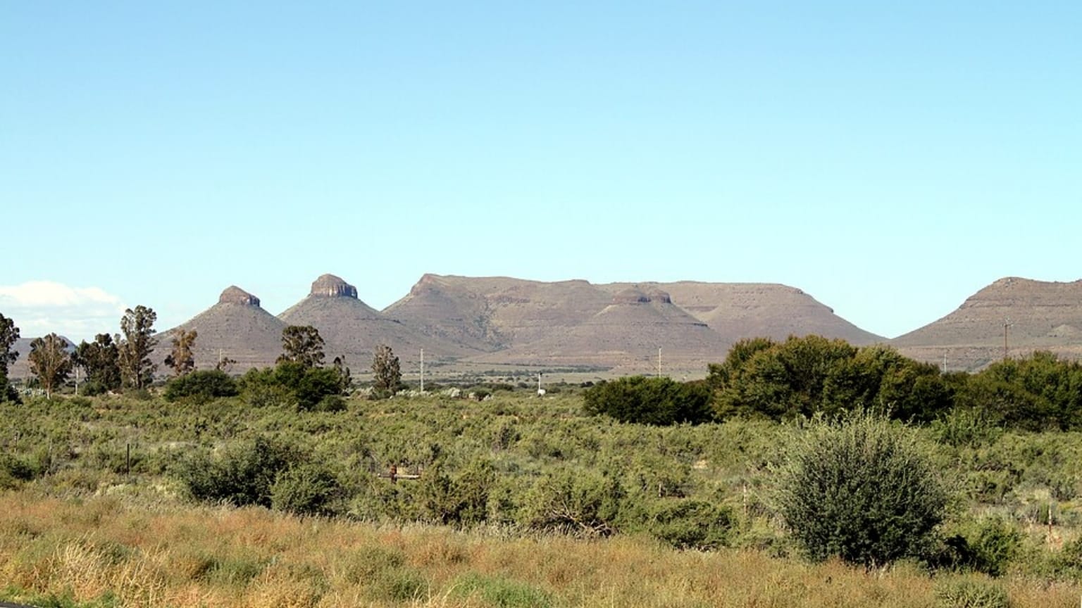
Extensive sheep farming became the central agricultural activity. Permanent occupation depended on access to springs and groundwater, followed later by boreholes and improved transport.
The railway and national road connected the Koup to distant markets while also turning it into terrain many South Africans pass through without really entering.
The Upper Karoo and its uncertain northern edge
The Upper Karoo occupies the higher interior around towns such as Victoria West, Richmond, Hanover, De Aar, Britstown and Colesberg.
This area is generally colder than the lower plains, with severe frost and a stronger summer-rainfall influence. Grass is more prominent in many areas, although unpredictable rainfall and drought are central facts of life.
The region gradually merges into the southern Free State. This makes the northern boundary particularly difficult to settle. Towns such as Philippolis, Fauresmith and even parts of the Trompsburg district share much of the Karoo’s architecture as well as its farming economy and historical experience.
The Upper Karoo was also profoundly altered by the railway. De Aar developed as one of South Africa’s most important railway junctions, while smaller settlements came up around stations and the movement of wool and passengers across the interior.
The Camdeboo and the eastern Karoo
The Camdeboo around Graaff-Reinet, Aberdeen and Nieu-Bethesda forms part of the eastern Karoo. Further east and north-east, the region becomes grassier as it approaches Cradock and the Eastern Cape interior.
Rain is a stronger summer component here. The vegetation reflects a transition between Karoo shrubland and thicket, especially around river valleys and mountain slopes.
The region has a complicated frontier history. San and Khoe communities were displaced as colonial settlement expanded. Enslaved people, farm workers, mission communities and Xhosa-speaking groups have all contributed to its development.
Graaff-Reinet became a major administrative and commercial centre, while merino sheep and wool connected the district to international markets. The eastern Karoo also occupies a prominent place in South African literature. Olive Schreiner drew on this landscape in The Story of an African Farm, while Eve Palmer later recorded the ecology and human history of the Camdeboo.
Why the Klein Karoo is not a smaller Great Karoo
The Klein Karoo’s enclosed valleys and access to mountain water produced a different economy from the extensive sheep country to the north. Irrigation supported vineyards and lucerne.
Oudtshoorn became the centre of the ostrich-feather industry, particularly during the booms of the late 19th and early 20th centuries. Wealth from feathers produced the town’s elaborate “feather palaces”, while railway links connected the industry to overseas buyers.
Calitzdorp developed a strong wine tradition. Other districts became known for fruit and mixed agriculture. The ecology is equally varied. Succulent Karoo, fynbos and thicket elements meet within the region, while mountain passes connect environments that can change dramatically over relatively short distances.
The Klein Karoo belongs to the wider Karoo family, but has its own agricultural history and culture.
A land occupied long before farms
Any definition of the Karoo must reach further back than trekboer expansion. San communities lived throughout the dry interior, leaving archaeological sites and a body of knowledge developed over thousands of years. Khoe pastoralists moved livestock through the region in response to grazing and water.
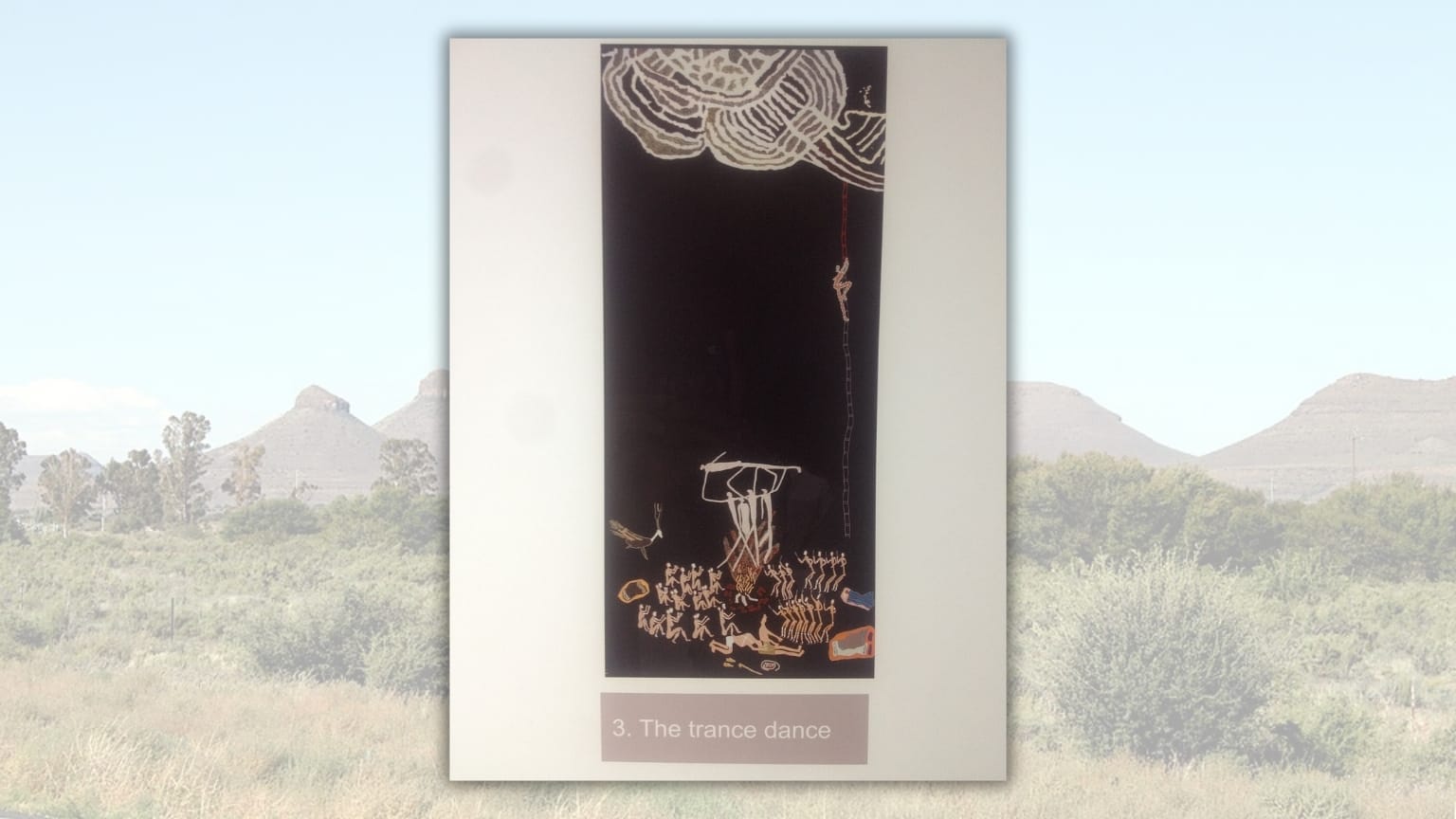
Colonial settlement restricted these movements. Land was granted and fenced. Conflict and dispossession transformed Indigenous communities and their relationships with the land.
Mission stations created new settlements where Khoe, San and freed slaves came to live, sometimes for protection and sometimes under considerable missionary control. These communities created the mixed ancestry and culture of the modern Karoo.
The cultural Karoo
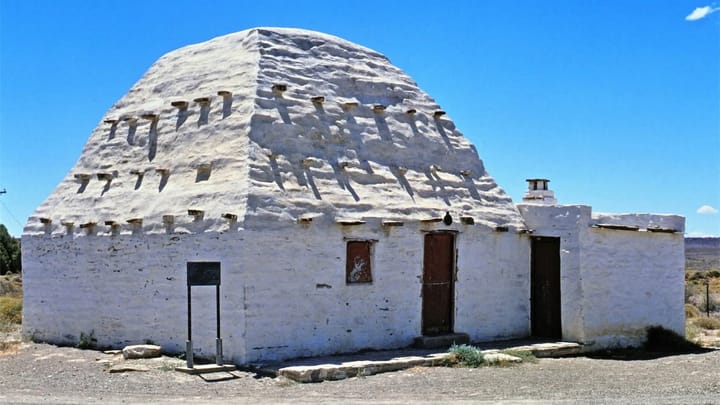
The cultural Karoo is even harder to map than the ecological one. Karoo architecture can be recognised in windpumps and long main streets. This culture is present in food and the relationships between isolated farms and small towns.
Afrikaans is widely spoken, but is not the Karoo’s only language. Regional forms of English, isiXhosa, Sesotho and the traces of Khoe and San languages all belong to the region's history.
Nor is there one Karoo community. A Coloured farm worker in the Klein Karoo, a sheep farmer near Hanover, a Xhosa-speaking family near Cradock and a new resident running a tourism business in Nieu-Bethesda all live in the Karoo while experiencing it differently.
What connects these groups is their shared negotiation with the limited opportunities of rural economies.
A region repeatedly reinvented
The modern Karoo is no longer supported by farming alone. Agricultural consolidation has reduced the number of people employed on many farms. Railway decline has weakened towns once sustained by trains and railway workers. Young people frequently leave in search of education and work.
At the same time, conservation, renewable energy, tourism and remote work have created new uses for old regions and buildings. Game farms and nature reserves occupy land once used primarily for livestock. Festivals and arts projects have given some towns new public identities. These changes generate opportunities, but also arguments about development and who benefits from the Karoo's reinvention.
So what makes a place Karoo?
Rainfall patterns differ across the Karoo; the Nama-Karoo and Succulent Karoo stretch beyond ordinary geographical definitions. The Tankwa, Klein Karoo, Upper Karoo and Camdeboo don't need to look identical to belong together.
Perhaps the most accurate definition is that the Karoo begins wherever dryness becomes the organising fact of life: where settlement was determined by water and distance still defines communities today, and where people learn that survival depends on respecting the limits of the land.
 Mariana Balt
 Liz Thorne
 Lynette Spencer
 Liz Thorne



Comments ()