
Why Uniondale exists where it does
Uniondale’s story begins with the land itself. Positioned along the Langkloof, the town reflects a meeting of routes, farming potential and natural geography that still affects life today.
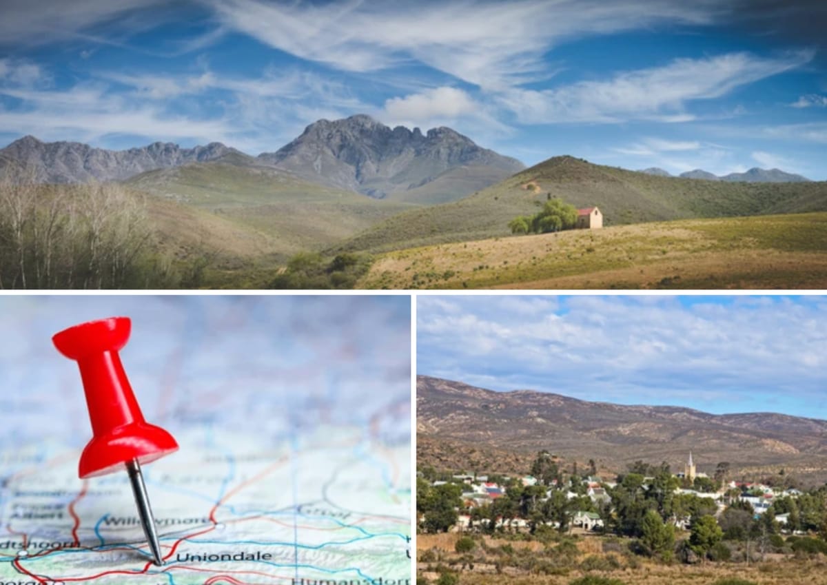
There are towns that seem accidental, and then there are towns that seem inevitable. Uniondale belongs firmly to the latter. The town's position, tucked into the western reaches of the Langkloof, is the result of geography determining human settlement over time.
To understand why the town exists where it does, one needs to step back and look at the terrain. The Langkloof is a long, narrow corridor that cuts between mountain ranges, stretching from the Eastern Cape towards the Western Cape. This corridor creates a natural route through otherwise difficult terrain, while also offering pockets of fertile land that contrast the harsher surrounding Karoo.
A corridor made by mountains
The Langkloof is flanked by rugged mountains that act both as barriers and as guides. On one side lie the Outeniqua and Tsitsikamma ranges, while on the other the drier, more austere ridges of the Karoo interior. These mountains limit movement across them, which means that travel tends to follow the path of least resistance, along the valley floor.
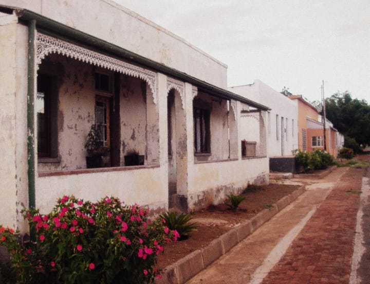
Uniondale is near the western entrance of this corridor. This position marks a transition point where travellers moving inland from the coast, or outward from the Karoo, naturally converge. The routes funnel and a settlement becomes necessary.
In this way geography begins to drive human decision-making. When people move through a region repeatedly, they begin to pause in the same places. Water and shelter become the anchors of settlement. Over time, those pauses turn into permanence.
Farming in a ribbon of fertility
The Langkloof is known for its agricultural potential, particularly when compared to the surrounding Karoo. The valley benefits from more consistent rainfall, as well as soils that are better suited to cultivation. While much of the Karoo needs adaptation, the Langkloof offers opportunity.
Uniondale’s position allows it to tap into this narrow ribbon of productivity. Farms stretch along the valley, producing fruit, vegetables and livestock, all supported by the slightly milder conditions. The town acts as a service hub for these farms, connecting rural producers with markets and resources.
This is where the relationship between land and livelihood becomes clear. The Langkloof concentrates farming: the geography channels water, creates soil conditions and microclimates that make agriculture viable in ways that would not be possible just a few kilometres away.
Uniondale, in turn, becomes the point where goods are traded and transported onward. Without the valley, the town would struggle to justify its existence. With the valley, the town becomes essential.
Trade routes and movement
Long before modern highways, the Langkloof functioned as a natural trade route. Traders and travellers followed its course because it offered the most practical passage between regions. The mountains dictated the direction of movement, while the valley provided the path.
Uniondale becomes a place to rest, resupply and exchange goods. Over time, these functions solidify into economic activity. Shops appear and the town begins to take on a life of its own. Even today, this dynamic remains visible. Roads follow the same logic that earlier travellers did, tracing the contours of the land rather than cutting across it. Uniondale continues to sit along a line of movement, linking the Karoo to the Garden Route and beyond.
A meeting point of lands
Uniondale also occupies a unique position between two distinct environments. To the south lies the lush, coastal influence of the Garden Route, while to the north stretches the dry, open expanse of the Karoo. The town lives between these worlds, drawing characteristics from both.
Farming practices reflect a blend of approaches, while daily life balances between abundance and restraint. The town becomes a place of transition, where different lands meet and interact. The Karoo geography surrounding Uniondale defines the limits of expansion and reinforces the importance of careful land management. At the same time, the proximity to the Langkloof softens these constraints, allowing for a degree of agricultural diversity.
Why the town continues today
Uniondale exists where it does because the land leaves little room for alternatives. The valley provides a route, the soil supports farming and the surrounding terrain channels movement into a single corridor. These factors combine to create a location that difficult to ignore.
The town’s endurance is tied to these same forces. While economies and populations evolve, the underlying geography remains constant.
The mountains still guide movement, the valley still supports agriculture and the routes still converge at the same point. In this sense, Uniondale is a response to history, a place made by the logic of the land.

Comments ()